We offer fast, safe and cost-effective drone (UAV) surveys to capture high-resolution aerial data across a wide range of environments. From topographical mapping to visual inspections, our drone services deliver accurate, georeferenced outputs, without the need for boots on the ground.
What is a drone survey?
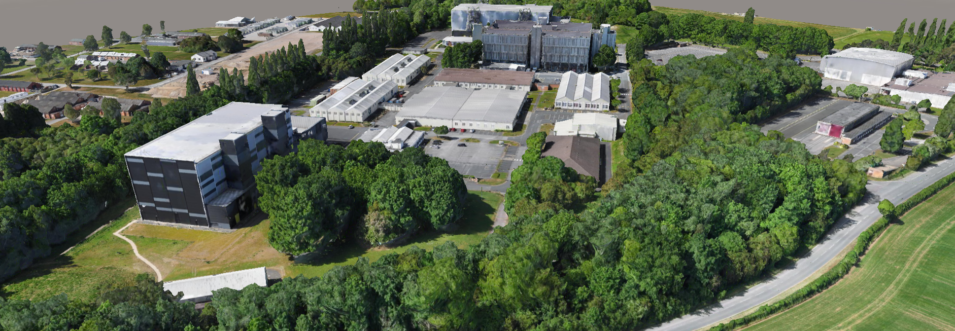
A drone survey uses unmanned aerial vehicles (UAVs) equipped with high-resolution cameras, LiDAR sensors or thermal imaging systems to collect data from above. This technology is ideal for surveying large, complex or hard-to-reach areas quickly, safely, and with minimal disruption.
Drone surveys are perfect for:
Large-scale topographical and land surveys
Construction progress monitoring and planning
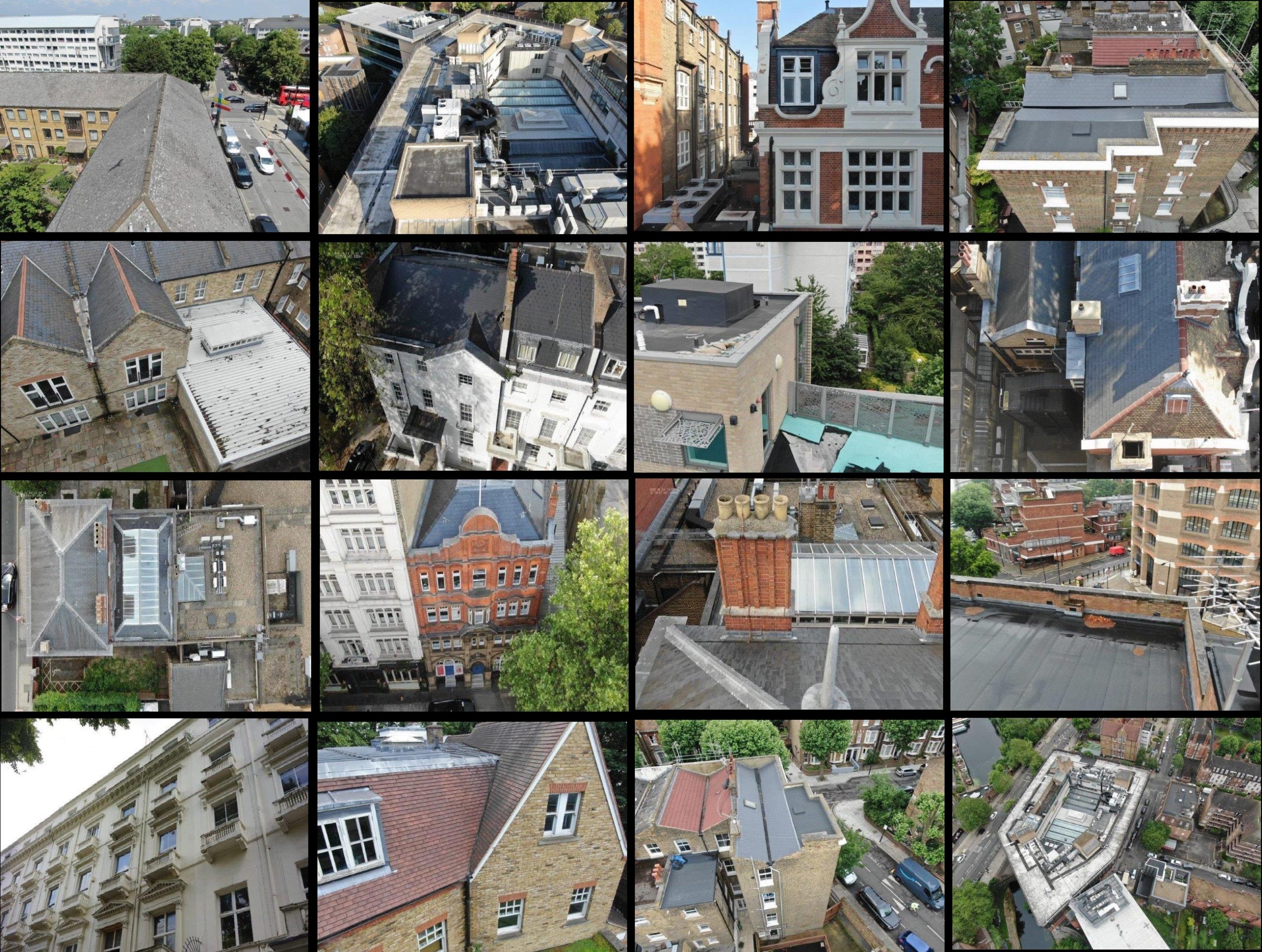
Roof, façade and structural inspections
Volumetric calculations and earthwork analysis
Environmental, flood risk, and ecological assessments
Fast, flexible data capture from above
Our qualified drone pilots operate CAA-approved UAVs and follow strict safety protocols to capture detailed aerial data in a fraction of the time of traditional methods. We deliver clear, measurable outputs that integrate seamlessly with your GIS, CAD or BIM environment.
We provide:
High-resolution aerial photography and orthomosaic imagery
Aerial LiDAR and photogrammetry-based point clouds
2D and 3D site models for planning and design
Volumetric measurements and stockpile analysis
Visual inspections for condition and asset monitoring
Why choose Vision Survey?
Fully licensed and insured drone survey teams
Fast mobilisation with minimal site disruption
Advanced equipment for accurate, georeferenced results
Suitable for remote, inaccessible or hazardous areas
Trusted by contractors, developers, and asset managers nationwide
Whether you need aerial mapping, building inspections or site visualisation, our drone surveys give you the clarity and coverage to make better, faster decisions.
Get in touch
Need fast, accurate data from above? Contact Vision Survey today to arrange a drone survey and discover how UAV technology can give your project a new perspective.