We provide accurate and fully compliant utility surveys to help you locate and map underground services before excavation or development begins. Our surveys reduce the risk of service strikes, improve planning confidence, and support safe, efficient project delivery.
A utility survey identifies the location, depth and type of underground utilities, such as electric, gas, water, telecoms and drainage infrastructure, using a combination of non-invasive techniques and physical verification. This information is essential for safe design, planning, and construction in built environments or greenfield sites.
Utility surveys are critical for:
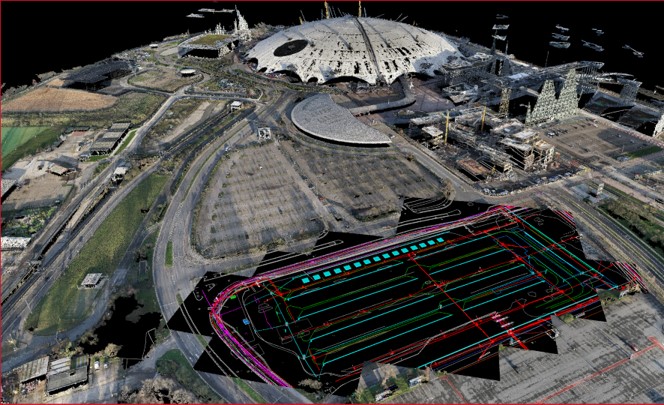
We use industry-leading techniques, including electromagnetic location (EML), ground penetrating radar (GPR), and vacuum excavation where required, to accurately detect and trace buried assets. Surveys are carried out to PAS 128 standards and tailored to suit your site conditions, project stage and information requirements.
Our service includes:
We deliver clear combined service models, 2D CAD/3D CAD/GIS drawings, reports, pit schedules and digital outputs to help you plan confidently and work safely.
Whether you’re breaking ground, planning a large infrastructure scheme, or designing within a congested urban site, our utility surveys give you the insight needed to de-risk your project from day one.

Looking to locate underground utilities with confidence? Contact Vision Survey today to arrange a utility survey and take the first step toward safer, smarter site delivery.